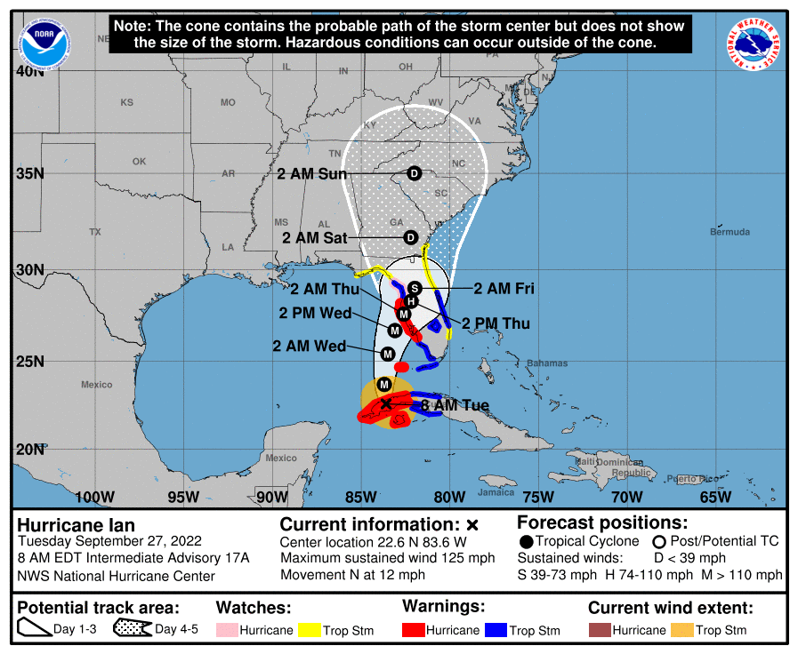
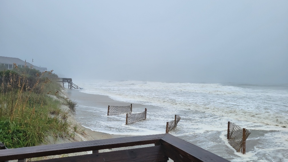
10/10 Updated Information
Sandpiper Run Elevators are back online.
Somerset - all pools and elevators open. Walkways currently
under repair.
Litchfield Retreat - 2 elevators working and pool is open. Beach Access across the street
is usable.
Inlet Point and Inlet Point South Guests may use the Inlet Point South Beach Access.
Inlet Point
elevators are still not working and pools are closed.
10/6 Updated Information
Inlet Point -
from the HOA:
You have probably seen bulldozers on the beach and many of you have questions about what is
going on. This is a process call “Sand Scraping” and is a beach and dunes renourishment process. Usually a DHEC
permitting process is required for Sand Scraping. But after Ian, DHEC released emergency orders stating that these
types of processes can be done without a permit in Georgetown and Horry counties, if it is done within the next 30
days... You can read these emergency orders here:
https://scdhec.gov/environment/your-water-coast/ocean-coastal-resource-management-ocrm/hurricane-ian-recovery-requirements
What is sand scraping? Simply put, at low tide, a bulldozer goes out far onto the sand and lowers their shovel one
foot into the sand. They are allowed one push of sand to the shoreline. Then, they go back out to the next furrow
and repeat, all the way down the beach. The first day, it may appear unsightly, but high tide will even out all of
the furrows and you have the advantage of native sand on your beach.
Inlet Point South & The Peninsula - from HOA:
Debris removal is occurring currently for all houses
as well as some minor dune work at the Peninsula. This should be completed in a few days. Pool closed for season
as usual.
The only access to the beach is at the Beach House. Please stay off the dunes... The rebuild of Somerset crossovers will start next week...
2 beach accesses open. Pool closed for season as ususal.
From the County regarding public beach access -
Beach access is limited in places as many beach access walkways were damaged from the storm surge. County staff continue to assess the safety of each beach access and walkway throughout Georgetown County. They completed their North Litchfield Beach assessment and believe that the following North Litchfield Beach access points are safe to use: 48, 50, 51, 52 and 55. You are urged to USE CAUTION on our beaches as there is still debris and other hazards that need to be cleaned up.
10/3 Monday Update
Cable and Internet restored to most areas.
Many beach walkways are being
repaired, but the beach is accessible in many locations where the dune was breached.
Pawleys Island - is open to the public this morning. The town has trash bins for debris.
Inlet
Point - see notes below. Power, cable, and internet up in all buildings except 9-12.
Elevators, pools, beach accesses not usable.
Litchfield By The Sea - internet & cable
restored. Community beach clubhouse access - 2 open, handicap being repaired. Tennis Courts
open.
Bridgewater - beach access is open, elevators ok.
Sandpiper Run & Crescent - All
elevators working, except none in A Building. Pool and hot tub are open. Grill area ok. South Beach
Access ok, North access is under repair.
Somerset - beach accesses under repair, use community beach
club.
Fordham, Whitney Parrish, Paget - elevators ok.
Cambridge, Warwick, Hamilton - 1
elevator working in each building.
Shipyard & Captains Quarters - All condos ok, elevators
and pool is up. Beach access being repaired, must use community beach club.
Heron Marsh - use
beach club access. Pool is closed.
Osprey Watch - our villas are ok. Water got into ground level
storage areas. Pool ok.
Marshhawk - all condos ok. Pool closed.
Charletowne Grant
- homes are ok, water in ground level storage and carport. Pool is closed. Beach walkways are being
repaired, must use beach club access.
- The county has not shared any plans for debris clean up. At this
time it is be conducted by each HOA.
- DHEC OCRM has issued blanket emergency orders to local governments in
Georgetown County to allow property owners along the immediate beachfront to conduct minor renourishment, sand
scraping, or installation of sandbags to provide temporary protection to beachfront structures from wave uprush.
10/2 Sunday morning Update with link to photos
• Buildings 1-8 had minimal to moderate damage
• Buildings 9-12 suffered significant water intrusion and large scale restoration will be needed. Electricity has been turned off to these units
• Buildings 14 -22 had their storage areas flooded
Building 14 still has no power.
• Building 13 - storage areas and apartment were flooded, beach side garage wall was destroyed
The sand dune was breached in several locations.
Elevator pits have been flooded and are not operational at this time.
The crab dock has been damaged and should not be used at this time.
Pools and pool bathrooms are not operational at this time.
ServPro is onsite for remediation where needed.
- North Causeway is open to property owners, hired contractors, and official rental company personnel
only. They plan to open the island to general public Monday around 10am.
- South Causeway will remain closed for the time being.
- All roads South of the intersection of Myrtle Ave and Pritchard will remain closed for the time being.
- Power has been restored to all of our rentals on the island.
- Water was never shut off on the Island, so there is currently no water boil advisory
Photos share on our Facebook
Page
10/1 /22 Saturday 2PM Update - The Dieter Company Office is open today. Please limit calls as we will be reaching out to all owners and renters with updates.
Most properties have no or limited beach access.
Some properties have no cable or internet.
No pools are
operational.
North Litchfied - most houses ok. A few beach walkways have damage.
Litchfield Retreat - has
power and 2 elevators running. Minor leaking around doors and windows. Pool closed.
South
Litchfield - Damage from rising water in many areas. Most creekfront houses had 3-4 ft of storm surge,
docks were damaged, ground level floors are not usable. Most oceanfront homes lost beach walkways and have water
damage in ground level living space. 2nd Row may have minor flooding on ground level. All public beach
access will need repair.
Inlet Point Houses - Ok, except several beach walkways.
Inlet Condos - Most condos are ok, water
being extracted from ground level of a few condos oceanfront and 2nd row. Marshfront bldg 9-12 have water inside
and no power. Power is still out in Bldg 14, but otherwise ok.
Water breached the dunes in several
areas, beach accesses are closed, pool is down.
Litchfield By The Sea
Most Houses ok
Bridgewater - closed for seasonal
maintenance
Sandpiper & Crescent - have power, all elevators working except Bldg A (working on it
now). North walkway down.
Somerset - Cambridge, Fordham, Warwick, Hamilton, Whitney Parrish,
Paget: The power and elevators have been restored to all buildings. The cable and internet are expected to
be restored by late evening. Briggs Landscaping is currently on the property with all the necessary equipment to
clean up the grounds. This will take several days to complete. The pools suffered significant damage and will be a
work in progress for quite some time. The crossovers will require some significant work if not a total
rebuild.
Shipyard & Captains Quarters - ok
Heron Marsh, Osprey Watch, Pelican Watch -
depends on the property. Ground floor storage flooded, have power, checking to see if ACs are
working.
Oyster Catcher - Most homes ok. Some water in ground level storage areas.
9/30/22 Friday Evening Update - The Dieter Company Office will be open Saturday regular hours.
The impacts of Hurricane Ian were worse than predicted. Our office will be open Saturday for regular hours.
Throughout the day we will be working with housekeepers and maintenance personnel to prepare for guests that are
scheduled to arrive and to check properties that are vacant.
Below is a brief summary of observations from this evening and a few pictures:
North Litchfield - fared
pretty well. There is water across the road on Boyle, screens are blown out, some walkways have damage, a little
standing water on Parker, but nothing like years past.
Litchfield By the Sea - Most beach walkways were damaged, the ocean barely breached the dune in a few areas, the lakes and marshes overflowed and flooded many ground-level storage areas of properties along their edge.
South Litchfield/ Inlet Point - Most walkways are damaged, the ocean breached the dune in several areas, a few homes with potential damage, creekfront homes, with ground levels, flooded potentially a few feet.
We will share more details as soon as possible tomorrow. Please limit calls as we are working hard responding to all owners and renters as quickly as possible.
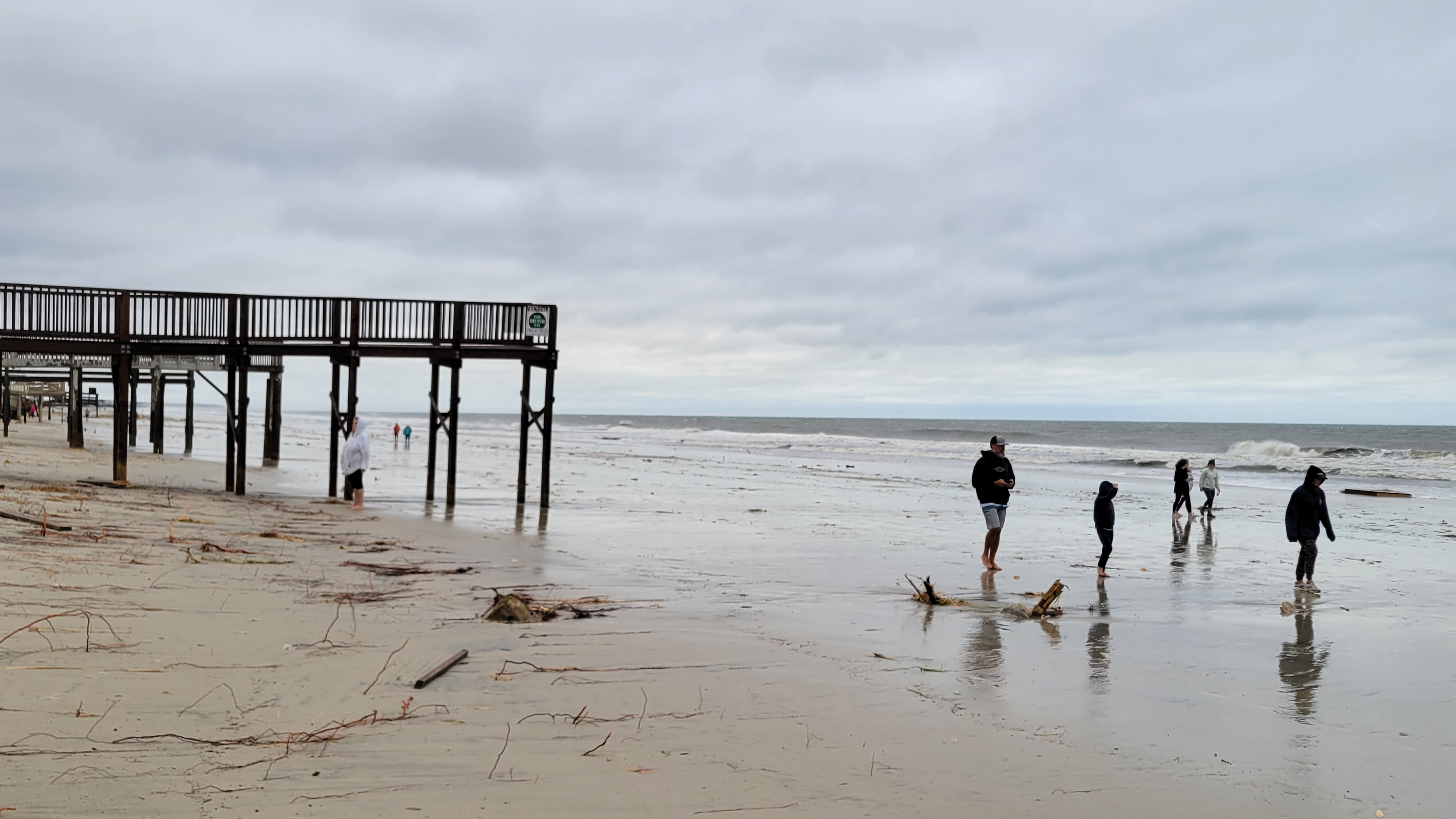
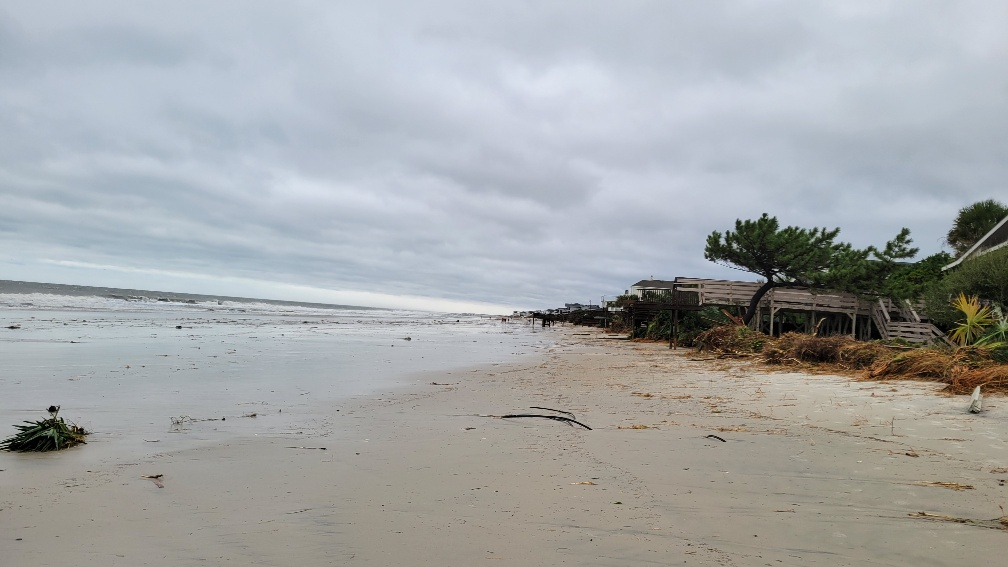
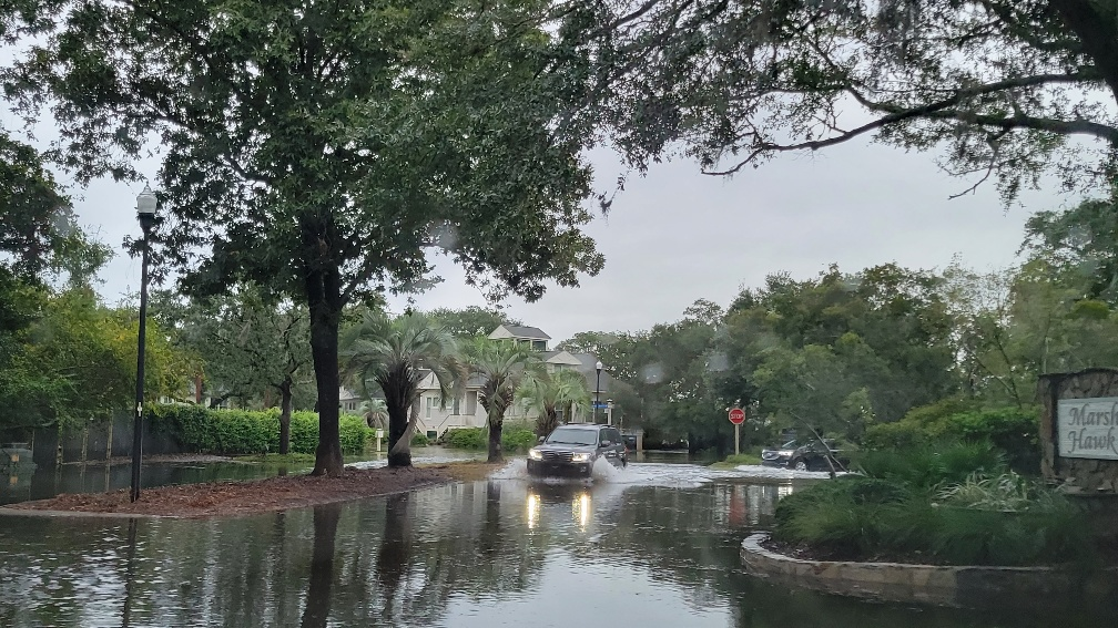
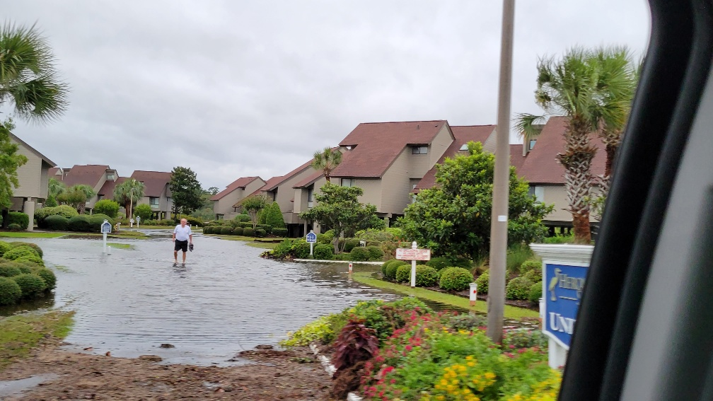
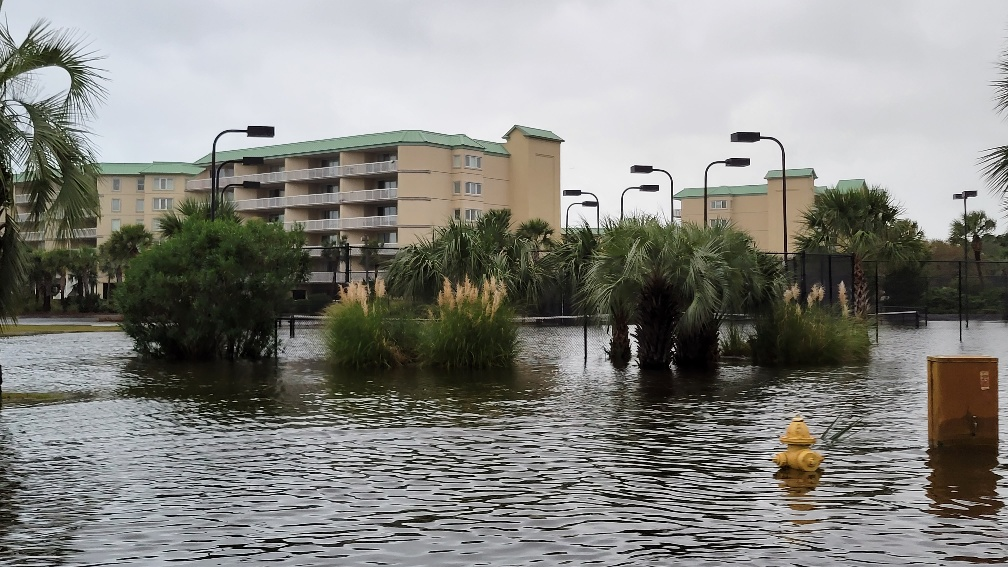
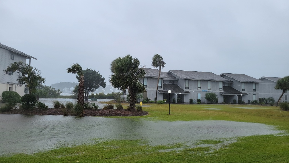
9/30/22, Friday Morning Update - The Dieter Company office will close at 10:30am on Friday. We plan to reopen for regular business on Saturday. Office staff will remain on call for emergencies
For Power Outages Call - Santee Cooper 888-769-7688.
Storm surge is expected to be 4-6'.
If you are in a low lying area experts suggest moving
vehicles to higher ground.
Here are the best resources for more information about the storm.
https://spaghettimodels.com/ Consolidated weather information
https://www.nhc.noaa.gov/ National Hurricane
Center
https://wpde.com/weather Local Weather Expert recent update below
Morning Update from Ed -
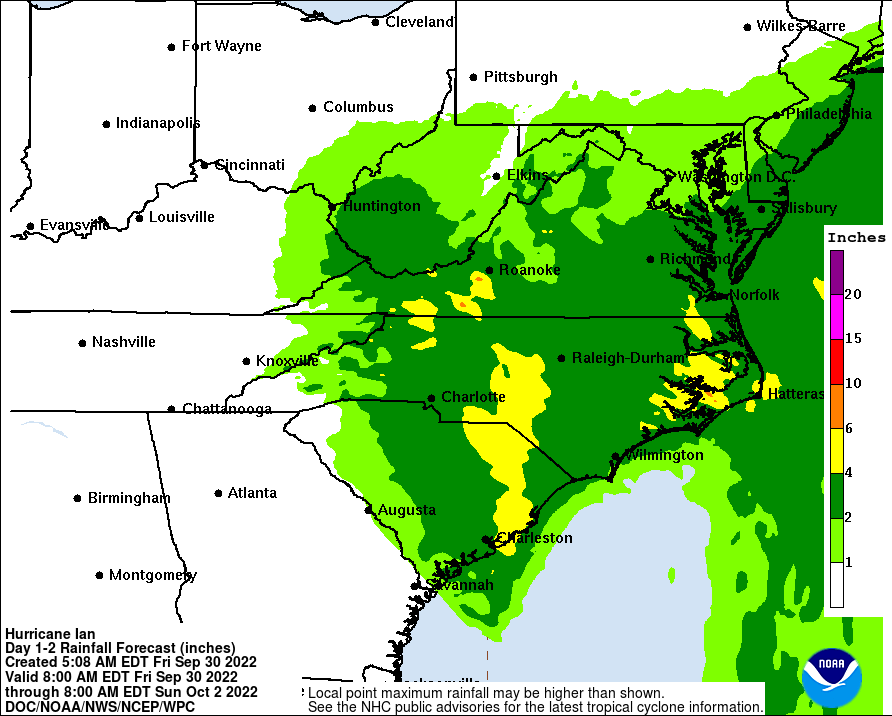
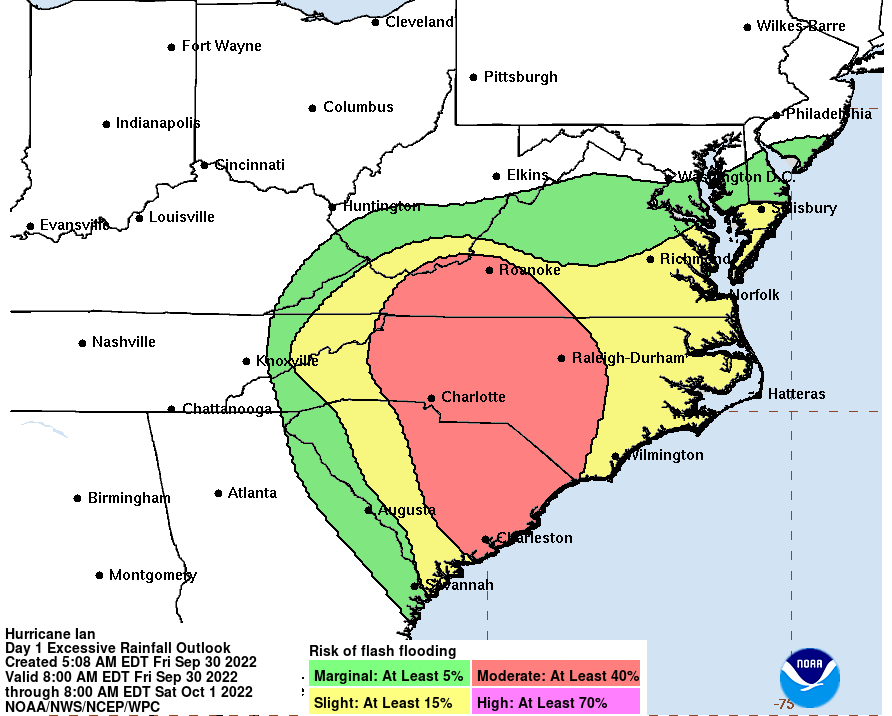
9/29 Thursday 2pm - The Dieter Company plans to open for a few hours Friday morning and regular hours on
Saturday.
Afternoon Update from Ed Piotrowski, WPDE:
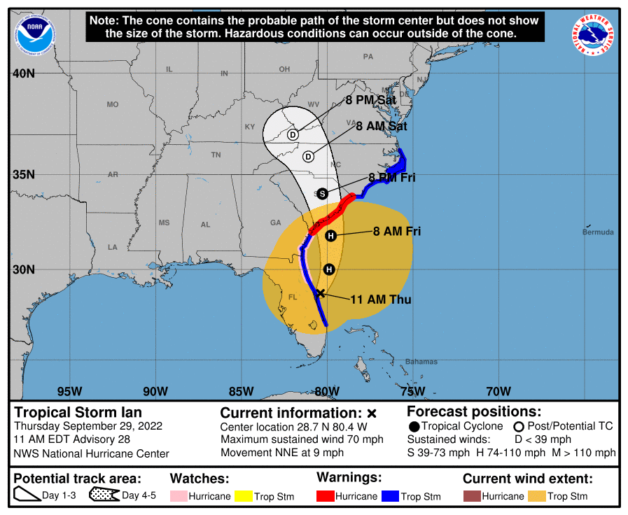
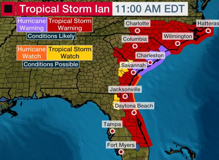
9/29/22 Thur 9:30am - The Dieter Company is open for regular business
Thursday morning update from Ed Piotrowski, WPDE:
"...likely little change in strength with Ian
up through landfall most likely near Charleston tomorrow afternoon...
RAIN: 3-7 inches (Heavy at times Friday.
Ends Friday late evening. Looks mostly dry Saturday.
WIND: 40-50 mph (few gusts to 55).
Ramping up Friday morning, peaking Friday afternoon and evening. Subsiding overnight.
TORNADO: small risk
Friday afternoon and evening.
SURGE: 2-4 feet Friday a few hours either side of high tide around 11:15am and
11:30pm...
Evacuations are NOT going to be issued. Even though a hurricane warning has been issued, most of you will NOT get
a hurricane-force wind."
Somerset Buildings in Litchfield By The Sea are closing elevators today at noon and will reopen when conditions allows (hopefully Saturday). This includes Cambridge, Fordham, Warwick, Hamilton, Paget, Whitney Parrish.
GFL has pushed the regular trash pickup through out the Litchfield Beaches from Friday to Saturday.
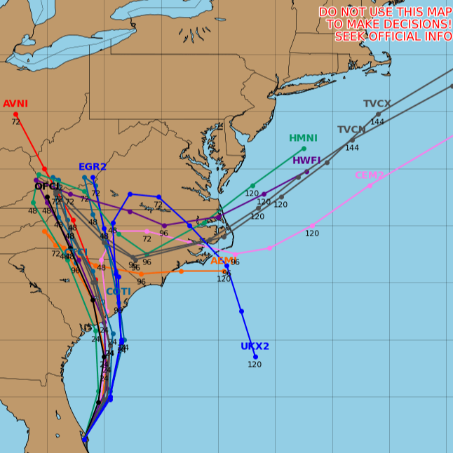
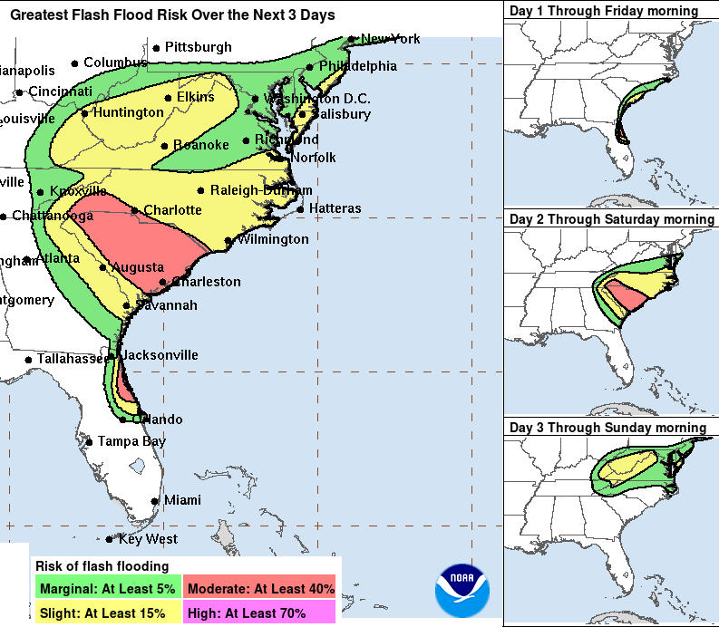
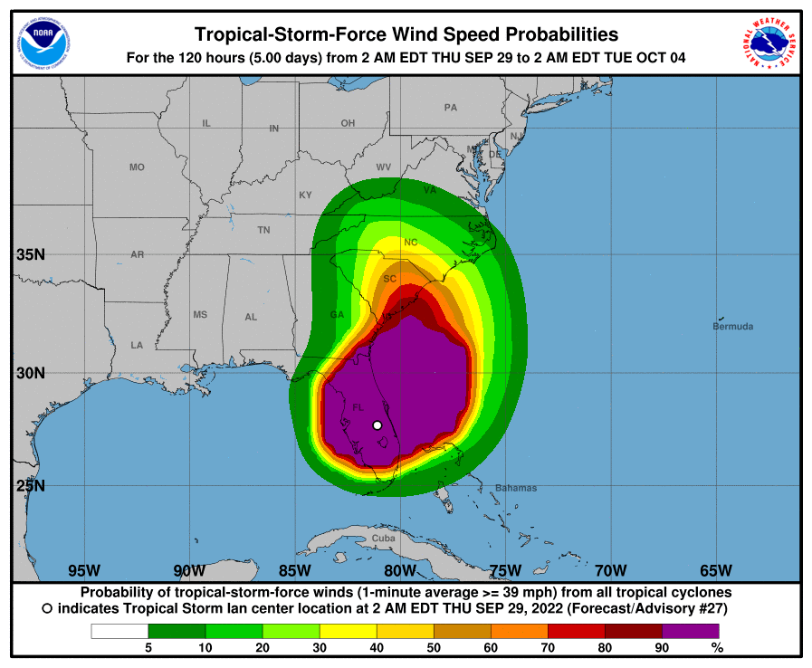
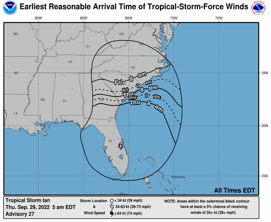
9/28/22, Wed, 9am - The Dieter Company will remain open for normal business hours and operations unless there is a drastic change in storm predictions. We are suggesting basic storm prep for oceanfront properties this afternoon or 1st thing tomorrow morning.
Guests currently at the beach are being asked to help or let us know if they need assistance.
Owner's
that have properties blocked for the off-season should let us know if they need help with storm prep.
Vacant
properties will be storm prepped, unless otherwise directed by the owners.
Secure outdoor furnishings that could blow around
Bring inside or turnover if too heavy or large to move
Wipe off or place on towels as needed
Check that all windows are latched
Close all window shades, curtains, or blinds
Dump all ice bins and turn icemakers off
Close all doors inside the property
Place the grill in storage if possible
Private home elevators raised to 1st floor
Notes from Ed Piotrowski, WPDE, about the expected impact from Ian:
WIND - Winds could gust 20-30 mph Thursday, 30-40 mph Friday and around 25-35 mph Saturday. Can't rule out a peak wind gust of 45 mph near the coast.
COASTAL FLOODING - Expect coastal flooding to occur around high tide Thursday and Friday.
Expect flooding to be similar to what we get with our bad king tides.
Note - some HOAs may temporarily close pools.
Important Numbers:
Emergency - 911
Power Out - Santee Cooper 888-769-7688
Flooding - Georgetown Storm Water Emergency 843-545-3524
If the numbers above do not apply then call The Dieter Company - 843-237-9800 (after hours follow voice prompts for emergency message).
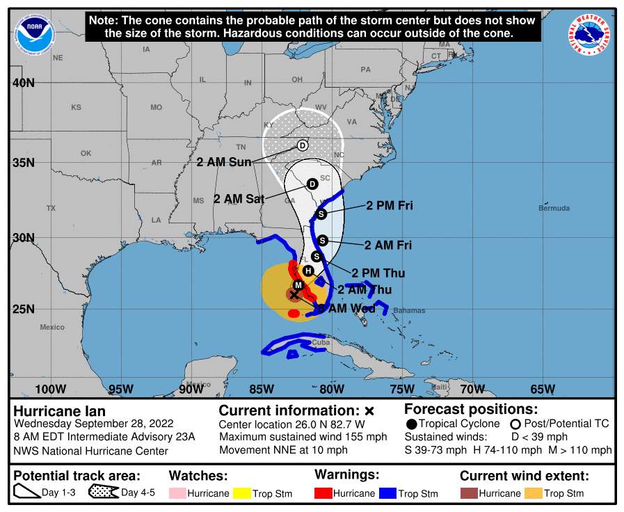
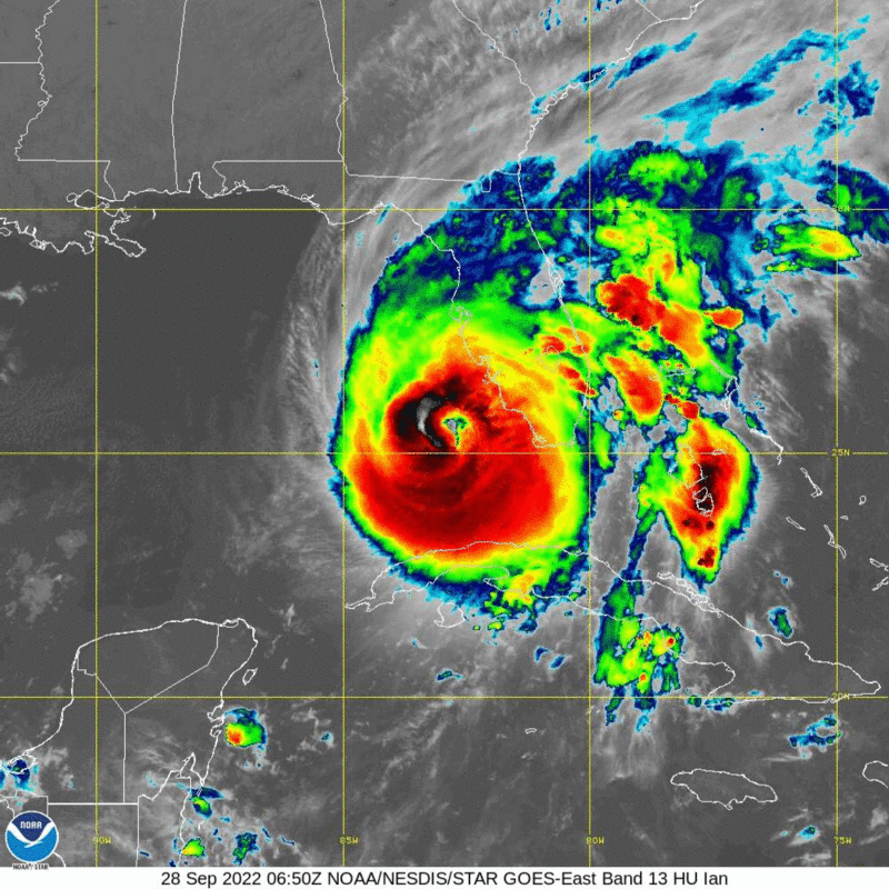
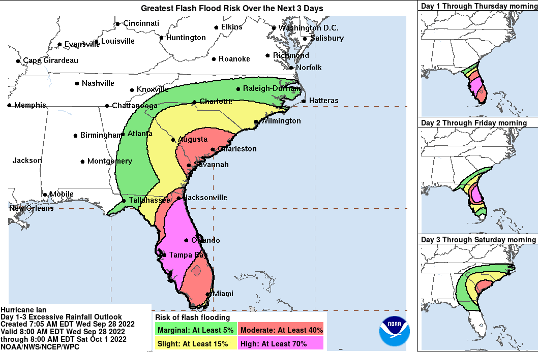
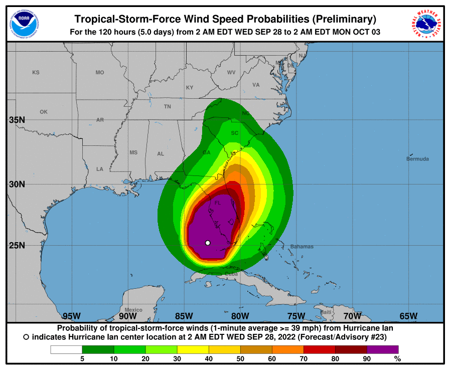
9/27/22, Tues, 10am - Dieter Company update for owners and renters.
We are closely monitoring Hurricane Ian and will provide updates as needed for owners and renters. There is no change for anyone currently at the beach on vacation, arriving or departing. Our office will be open for normal business hours unless forecasts change.
Here are the best resources for more information about the storm.https://spaghettimodels.com/ Consolidated weather information
https://www.nhc.noaa.gov/ National Hurricane Center
https://wpde.com/weather Local Weather Expert recent update below
