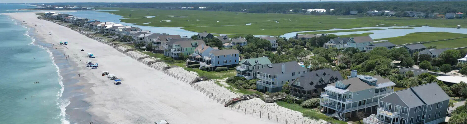
View Info for Tropical Storm Idalia heading towards Pawleys Island & Litchfield Beach.
8/31 Thursday Afternoon after Idalia
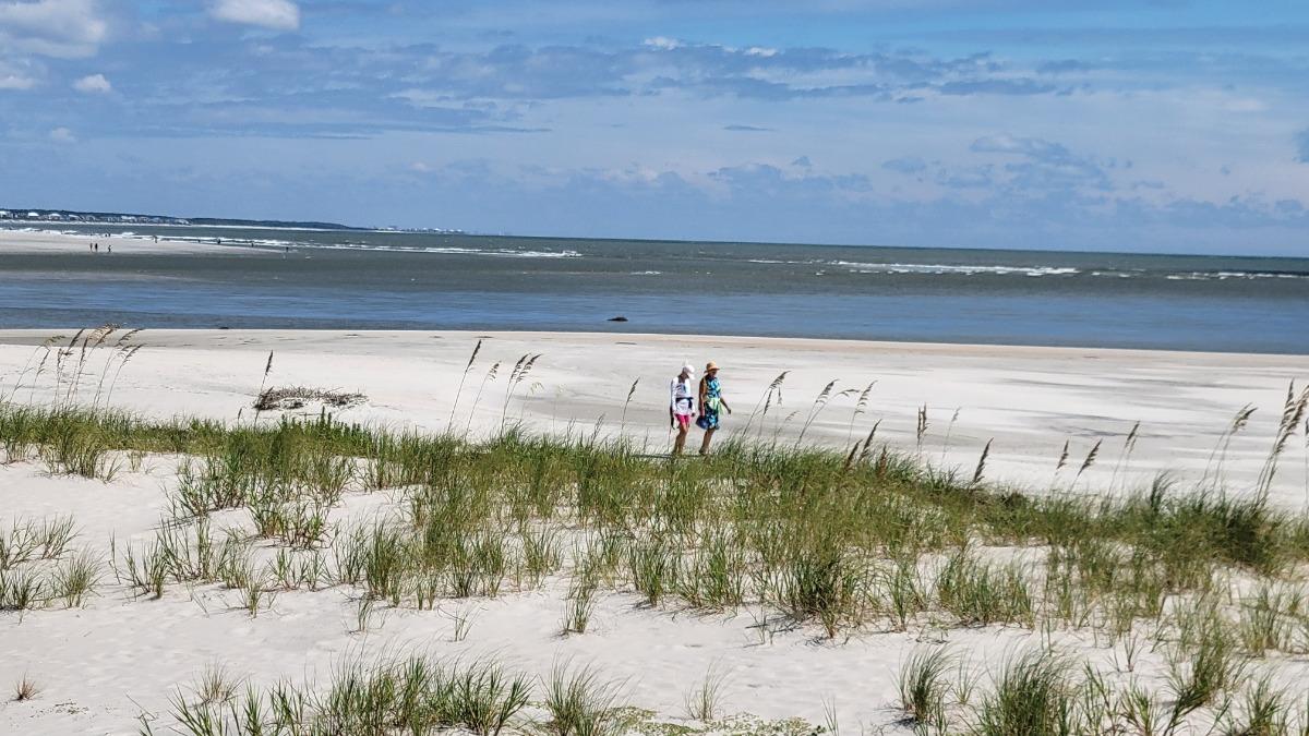
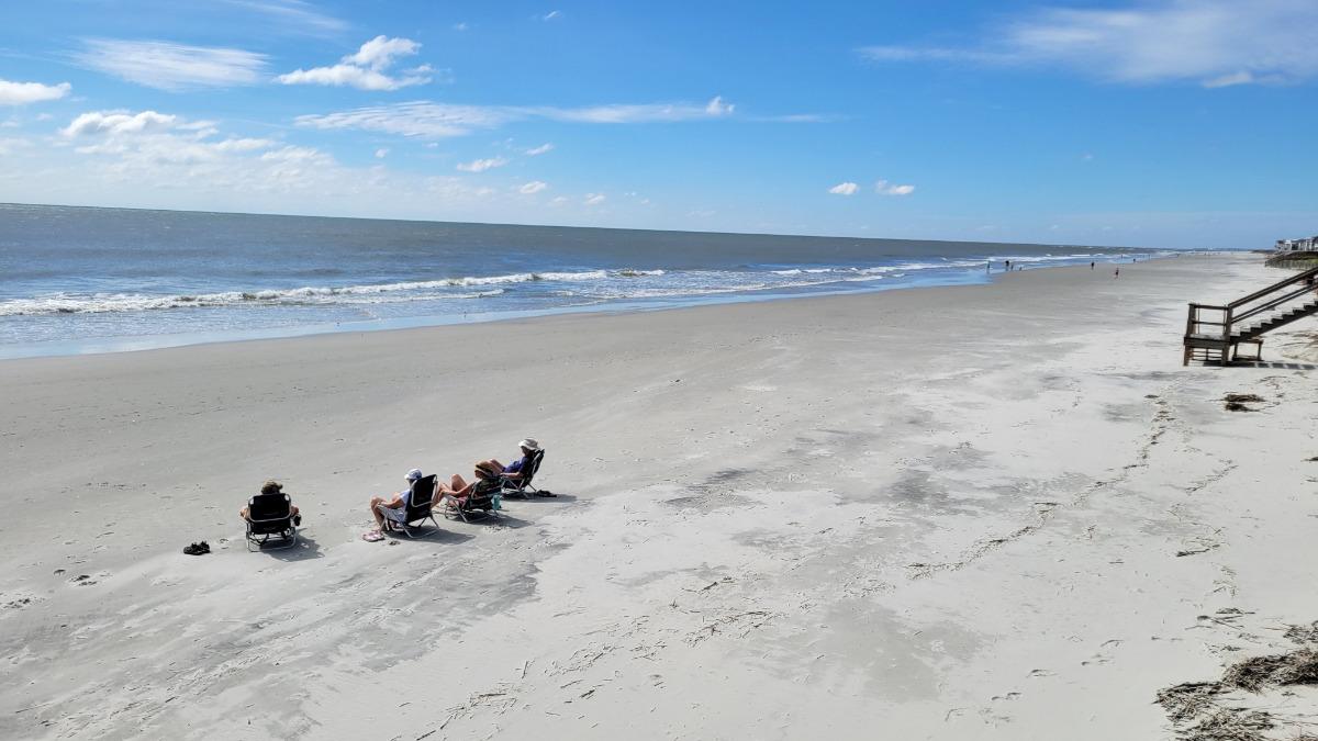
It’s a beautiful afternoon in Pawleys Island! We have reached out to all renters who are currently occupying properties and/ or walked through homes showing vacant this week. Thankfully, there have been very few issues to report. Just a few screens were blown out and yard debris scattered about. Any owners with damages beyond this have been contacted today by our office. All renters scheduled to arrive over the holiday weekend have been given the all-clear and told to come as scheduled.
We have a lot to be thankful for after this storm. Enjoy the beautiful weekend ahead and hope to see you around the beach very soon!
8/31 Thursday Morning after Idalia
Overall our area has a lot to be thankful for as the impacts of Idalia appear to be less than other recent storms. The power is on and there is no standing flood water. We are already reaching out to renters asking for a response about any damages that occurred overnight. Our rental staff and housekeepers are out inspecting the area and vacant homes first thing this morning. Throughout the day we will be working with housekeepers and maintenance personnel to prepare for guests that are scheduled to arrive and to check properties that are vacant. If your home is blocked for owner use please let us know if it needs to be inspected. Our office is open for regular hours, but we are asking people to limit calls so that we can respond to the most urgent needs first.
For renters scheduled to arrive over the next few days there is no change, unless we have called you with other details. The weather looks beautiful over the next few days!!!
8/30 Wednesday Afternoon Hurricane Idalia Update - TROPICAL STORM WARNING IN EFFECT Bullet points below paraphrased from WPDE news:
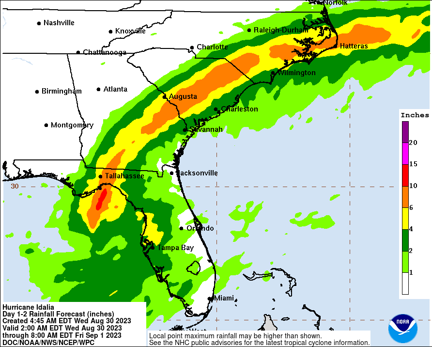
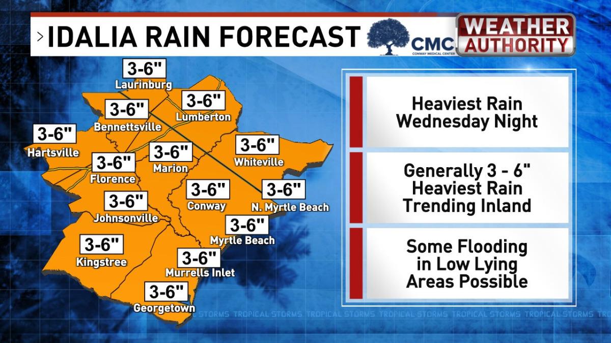
RAIN- Showers/storms will gradually increase this afternoon but the heaviest rain bands move through between 6 PM tonight and 4 PM Thursday.
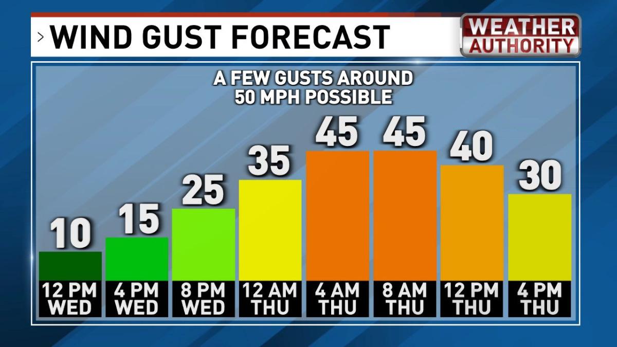
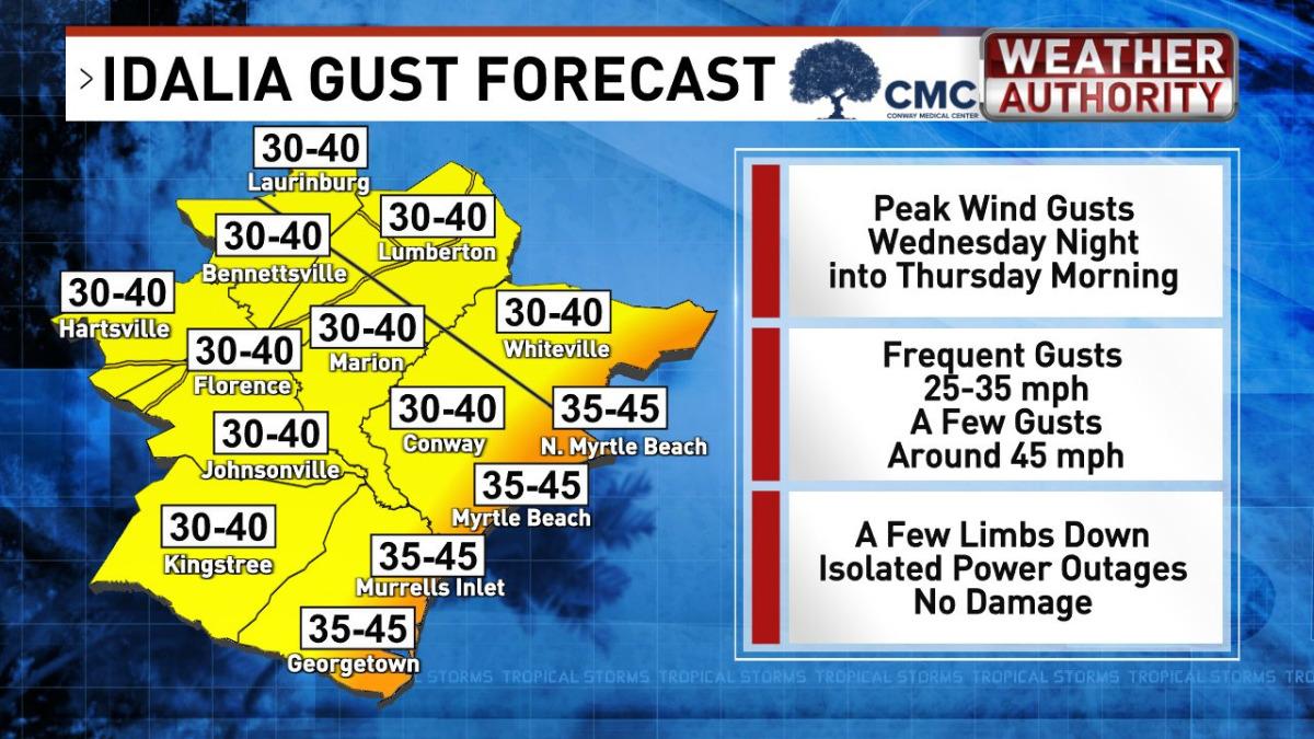
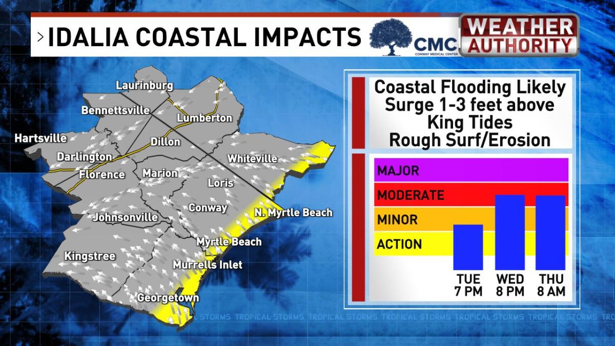
FLOOD- Flash flooding possible around creeks, ponds, and ditches, and some road flooding. Up to 4" possible. The risk of flooding here is lower but not zero. Potential coastal flooding around high tide this evening around 8pm. Per National Hurricane Center, the 1-3 ft storm surge should be below Ian and Isaias. By Thursday morning's high tide at 8am, the wind should be offshore to minimize l flood potential. WIND- Gusty, mostly non-damaging wind is likely Wednesday night through Thursday morning. Winds will frequently gust around 35 - 40 mph and there will be several gusts around 50 mph.
Important Contact Information Power Outages - 888-769-7688 Spectrum Cable/ Internet Outage - 843-913-7941 Emergency – 911 Property Emergencies that cannot wait until tomorrow 843-237-9800
8/30 Wednesday Morning Hurricane Idalia Update
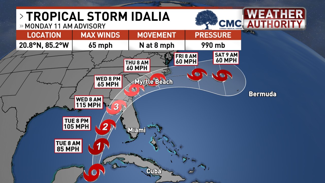
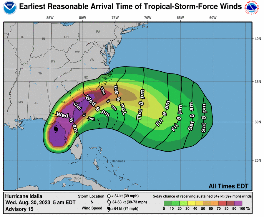
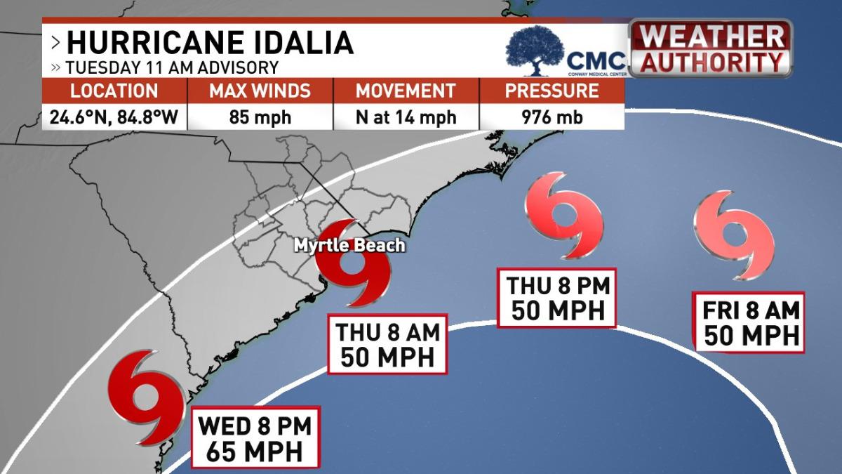
Hurricane Idalia made landfall in Florida around 745 AM EDT as a category 3 with winds of 125 mph. It is expected to rapidly deteriorate as it heads towards our area late afternoon into the evening. Recent reports are encouraging for Pawleys Island as the storm is expected to track further west which will bring less rain. Also the peak storm surge is looking like it will not arrive during the peak high tide, which equals less flooding.
The Dieter Company is open today and tomorrow, but please limit your calls. Regular updates will be provided on our website. Thank you!
Several HOAs have decided to close elevators down this after and will reopen them tomorrow as conditions allow. This includes all of Somerset in Litchfield By The Sea - Fordham, Cambridge, Warwick, Hamilton, Whitney Parrish, Paget, Sandpiper Run and Crescent, All of Inlet Point, All of Litchfield Retreat. Shipyard Village, Captains Quarters, and Bridgewater have not confirmed, but are likely to shut down as well.
Properties around the creek, marsh, and lake areas are prone to flooding during king tides. Coastal Dish Restaurant in Litchfield By The Sea and the North side of the Food Lion have offered up their parking lots as potential areas to relocate vehicles overnight.
For Renters scheduled to arrive over the next few days there are no changes at this time. The weather looks beautiful for the holiday weekend! We will post an update after the storm passes through tomorrow.
8/29/23 Tuesday Afternoon Hurricane Idalia Update
As expected, a tropical storm watch has been issued for our area. Our office is open regular days this week.
We are reaching out to current guests and asking them tohelp with the following before by tomorrow afternoon. Contact us immediately if you need assistance and we are glad to help. If properties are owner-occupied or vacant, let us know if you need assistance. Ensure all windows, doors, and screened doors are locked/ latched. Bring in lightweight outside furnishings. Turn heavy (or dirty) items so they will not blow away. Place grill in storage if possible. In the unlikely event power goes out, notify Santee Cooper 888-769-7688. Thursday afternoon let us know ifyour rental experiences any damage from the storm.
* Condo HOA’s may shut down elevators if the wind requires it and will be back online as soon as it is safe.
* Some properties may experience flash flooding. We suggest moving vehicles to higher ground if needed. King tides are expected on Pawleys Island.
Update from meteorologist Ed Piotrowski - “Once Idalia comes ashore, it will weaken rapidly and the center will pass near [our area] Wednesday evening through Thursday morning as a tropical storm. Idalia will be moving relatively fast by tropical standards so this system will be in and out of here quickly.”
Here's a paraphrase of what to expect:
RAIN - Showers/storms will gradually increase Wednesday afternoon and heaviest rain during the evening and overnight. By tropical standards, that's not a ton of rain but some localized flooding is possible.
WIND - Gusty, mostly non-damaging wind, around 35mph, is likely Wednesday night through Thursday morning. Wind of this magnitude typically produces little damage and isolated power outages.
COASTAL – Onshore wind will cause king tides Wednesday evening and Thursday morning higher than usual. Coastal flooding/surge for Ian was 5-7 ft. Current projections from NHC suggest a 1-3 ft. storm surge with Idalia.
Helpful Contact Provided by The Chamber of Commerce
Town of Pawleys Island: The Town of Pawleys Island Police Department encourages residents and guests on the island to move vehicles to the mainland this afternoon/evening as greatest impacts for flooding are from approximately 9 pm to 2 am.
The Dieter Company plans to be open for normal business hours all week. We
are keeping a close eye on Tropical Storm Idalia and will any important updates as details change. Our
favorite sources of information are: https://spaghettimodels.com/ Consolidated weather information https://www.nhc.noaa.gov/ National Hurricane
Center https://wpde.com/weather Local Weather Expert recent update below
Details below are shared this afternoon from Ed Piotrowski -
- Timing is Wednesday afternoon - Thursday morning
DEEPER DIVE
Tropical Storm Idalia is getting better organized and is poised to steadily, if not rapidly,
intensify today through landfall Wednesday morning on the west coast of Florida. Once Idalia comes ashore, it
will weaken rapidly and the center will pass near or over the Grand Strand late Wednesday afternoon through
Thursday morning as a tropical storm.Idalia will be moving fast so this system will be in and out of
here quickly. Understandably, everyone wants to know precisely what impacts we'll see here. That is
becoming clearer but there's still uncertainty in the details. So as I said yesterday, here's a general idea of
what I expect.
TIMING - Worst of the weather from Wednesday afternoon through Thursday morning. As long as
the system doesn't slow down, Friday through Monday actually looks beautiful.
RAIN - With a stalled front over us, scattered showers and storms are likely today and Tuesday.
More widespread, heavy rain looks to gradually arrive Wednesday afternoon and evening, continue Wednesday
night and end Thursday morning. Where the heaviest band of rain sets up will depend on the exact track.
Closer to the coast, more rain inland. A track offshore would bring the heaviest rain closer to the coast. 3-6"
with isolated higher amounts possible. That could lead to some flooding in low-lying areas. At least the
system is moving fast so it won't linger and produce outrageous rain totals that lead to widespread
flooding.
WIND - Gusty, mostly non-damaging wind will be possible as the system moves by. 40 mph wind
gusts are not out of the question.
TORNADO - A low-end tornado risk is possible mainly near the coast Wednesday afternoon and night.
COASTAL - With the track very near or offshore of the Grand Strand, a stiff onshore wind may cause
king tides Wednesday evening to run even higher than usual. With that said, I don't see the coastal
flooding/surge being as bad as Ian. Ian's surge was 5-7 ft. for the Grand Strand. Early projections
(obviously subject to change) from NHC suggest a 1-3 ft. storm surge will be possible with Idalia. Why the
difference? Idalia will be weaker when it arrives here and moving parallel and away from our coastline…not
coming ashore perpendicularly like Ian did. Still, it's important to check back for updates.